
File:Paradise Cay, Marin County.jpg
Tamaño di bista previo: 800 × 500 pixels. Otro resolushon: 320 × 200 pixels | 640 × 400 pixels | 1,024 × 640 pixels | 1,280 × 800 pixels | 2,560 × 1,600 pixels | 5,181 × 3,238 pixels.
Fail original (5,181 × 3,238 pixel, tamaño di fail: 15.83 MB, MIME type: image/jpeg)
Resúmen
| Deskripshon |
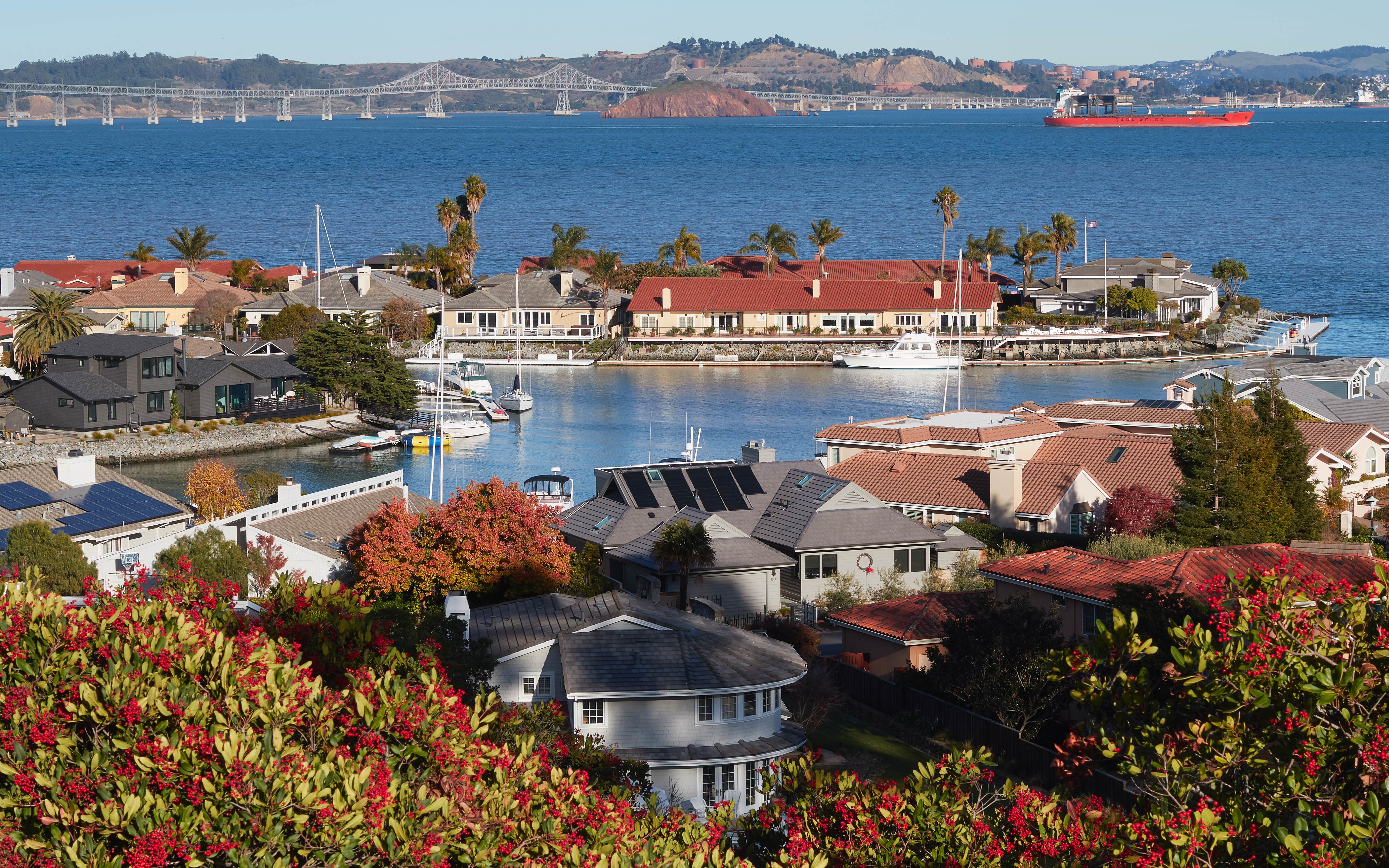
English: View of Paradise Cay near Tiburon, Marin County, California |
| Fecha | |
| Fuente | Obra propio |
| Outor | Frank Schulenburg |
| Camera location | | View this and other nearby images on: OpenStreetMap |
|---|
Lisensia
I, the copyright holder of this work, hereby publish it under the following license:
This file is licensed under the Creative Commons Attribution-Share Alike 4.0 International license.
- Bo ta liber:
- pa kompartí – pa kopia, distribuí i transmití e obra
- pa rekombiná – pa adaptá e obra
- Di akuerdo ku e próksimo kondishonnan:
- atribushon – Bo mester duna krédito na e outor, duna un lenk na e lisensia, i indiká si a hasi kambio. Bo por hasi esei na kualke manera rasonabel, perono na manera ku por sugerí ku esun ku ta otorgá e lisensia ta respaldá abo òf bo uzo.
- kompartí meskos – Si bo meskla, transfrmáòf modifiká e obra bo mester distribuí bo kontribushonnan bou di [mes lisensia https://creativecommons.org/share-your-work/licensing-considerations/compatible-licenses òf unu kompatibel] ku esun original.
This image has been assessed using the Quality image guidelines and is considered a Quality image.
|
Historia di fail
Klek riba un fecha/ora pa mira e fail, manera e tabata na e momentu ei.
| Fecha/Ora | Miniatura | Dimenshonnan | Usuario | Komentario | |
|---|---|---|---|---|---|
| aktual | 02:14, 3 desèmber 2016 | | 5,181 × 3,238 (15.83 MB) | Frank Schulenburg | lens profile corrected |
| 01:51, 3 desèmber 2016 |  | 5,181 × 3,238 (15.97 MB) | Frank Schulenburg | brightness toned down a bit | |
| 01:43, 3 desèmber 2016 |  | 5,181 × 3,238 (16.1 MB) | Frank Schulenburg | brightness slightly adjusted | |
| 01:35, 3 desèmber 2016 |  | 5,181 × 3,238 (15.88 MB) | Frank Schulenburg | User created page with UploadWizard |
Uso di fail
E próksimo page uses ta uza e fail akí:
Uso global di fail
E próksimo otro wikinan ta usa e fail akí
- Uso na an.wikipedia.org
- Uso na ar.wikipedia.org
- Uso na ast.wikipedia.org
- Uso na bg.wikipedia.org
- Uso na ca.wikipedia.org
- Uso na ce.wikipedia.org
- Uso na de.wikipedia.org
- Uso na en.wikipedia.org
- Uso na eo.wikipedia.org
- Uso na es.wikipedia.org
- Uso na eu.wikipedia.org
- Uso na fa.wikipedia.org
- Uso na fr.wikipedia.org
- Uso na ht.wikipedia.org
- Uso na ilo.wikipedia.org
- Uso na it.wikipedia.org
- Uso na lij.wikipedia.org
- Uso na oc.wikipedia.org
- Uso na pl.wikipedia.org
- Uso na sw.wikipedia.org
- Uso na tt.wikipedia.org
- Uso na uk.wikipedia.org
- Uso na uz.wikipedia.org
- Uso na vec.wikipedia.org
- Uso na vi.wikipedia.org
- Uso na vo.wikipedia.org
- Uso na www.wikidata.org