
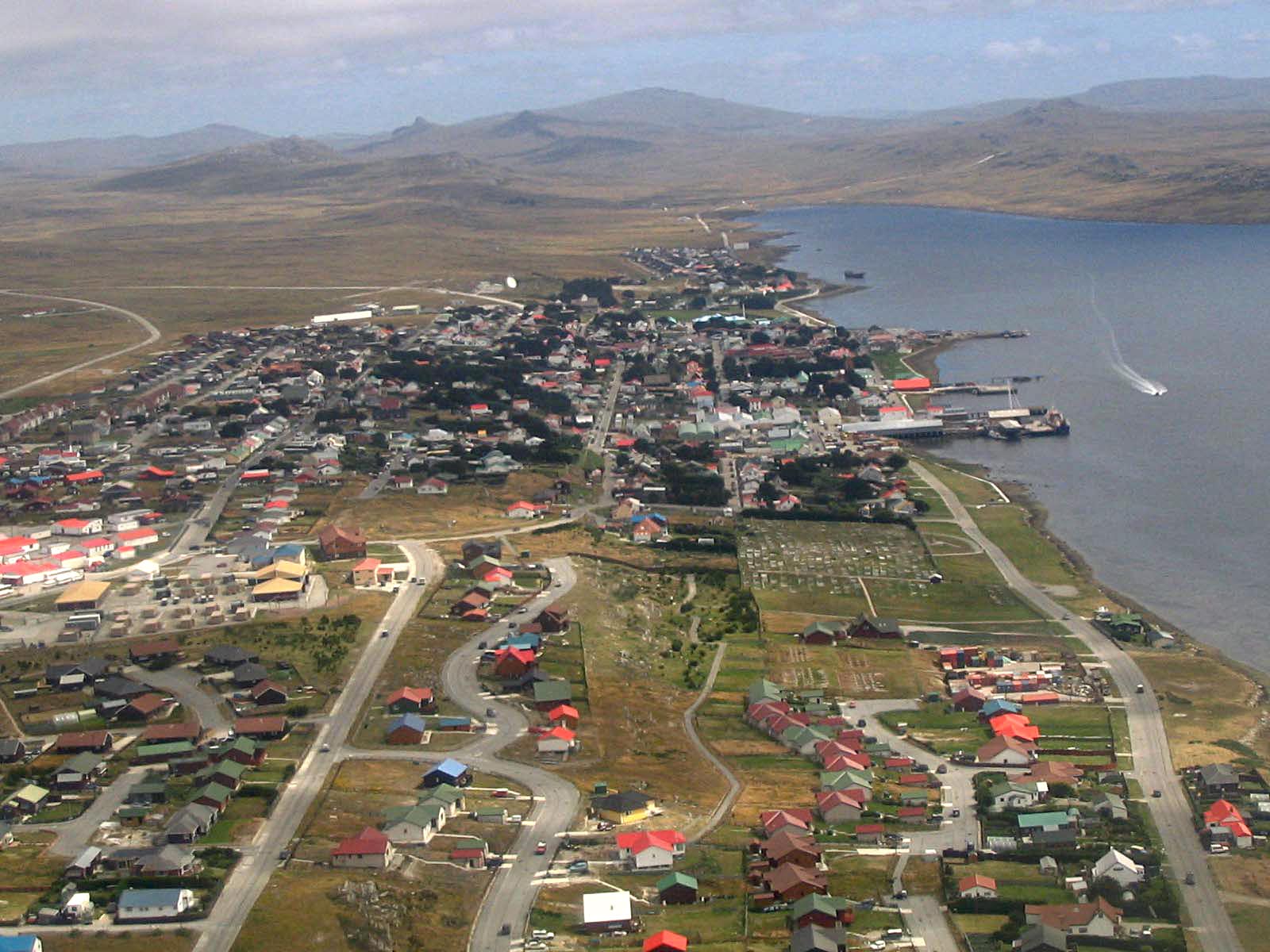
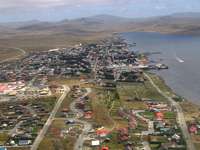
File:Aerial photo Port Stanley.jpg
Tamaño di bista previo: 800 × 600 pixels. Otro resolushon: 320 × 240 pixels | 640 × 480 pixels | 1,024 × 768 pixels | 1,280 × 960 pixels | 1,600 × 1,200 pixels.
Fail original (1,600 × 1,200 pixel, tamaño di fail: 220 KB, MIME type: image/jpeg)
| Camera location | | View this and other nearby images on: OpenStreetMap |
|---|
Resúmen
This image was copied from wikipedia:en. The original description was:
Port Stanley, from the air, 2005/02, by Tom L-C.
| date/time | username | edit summary |
|---|---|---|
| 22:16, 15 February 2005 | Tom L-C | (GFDL) |
| 22:13, 15 February 2005 | Tom L-C | (Port Stanley, from the air) |
Lisensia

|
Ta pèrmití kopia, distribuí i/òf modifiká e dokumento akí segun e GNU Free Documentation License, Vershon 1.2 òf kualke vershon mas resien publiká pa Free Software Foundation; sin Sekshon Invariante, sin teksto Front-Cover, i sin teksto Back-Cover. Un ehemplar di e lisensia ta inkluí den e sekshon yamá Lisensia di Dokumentashon Liber GNU. |
| E fail akí tin lisensia Creative Commons Attribution-Share Alike 3.0 Unported. | ||
| ||
| This licensing tag was added to this file as part of the GFDL licensing update. |
Historia di fail
Klek riba un fecha/ora pa mira e fail, manera e tabata na e momentu ei.
| Fecha/Ora | Miniatura | Dimenshonnan | Usuario | Komentario | |
|---|---|---|---|---|---|
| aktual | 20:26, 2 sèptèmber 2013 | | 1,600 × 1,200 (220 KB) | Hohum | Levels |
| 19:03, 11 ougùstùs 2005 |  | 1,600 × 1,200 (193 KB) | Head | This image was copied from wikipedia:en. The original description was: Port Stanley, from the air, 2005/02, by Tom L-C. {{GFDL}} {| border="1" ! date/time || username || edit summary |---- | 22:16, 15 February 2005 || Tom L-C || <nowik |
Uso di fail
E próksimo page uses ta uza e fail akí:
Uso global di fail
E próksimo otro wikinan ta usa e fail akí
- Uso na af.wikipedia.org
- Uso na ar.wikipedia.org
- Uso na arz.wikipedia.org
- Uso na ast.wikipedia.org
- Uso na azb.wikipedia.org
- Uso na az.wikipedia.org
- Uso na bat-smg.wikipedia.org
- Uso na be-tarask.wikipedia.org
- Uso na be.wikipedia.org
- Uso na bg.wikipedia.org
- Uso na bn.wikipedia.org
- Uso na br.wikipedia.org
- Uso na bs.wikipedia.org
- Uso na ca.wikipedia.org
- Uso na ceb.wikipedia.org
- Uso na cs.wikipedia.org
- Uso na da.wikipedia.org
- Uso na de.wikipedia.org
- Uso na de.wikivoyage.org
- Uso na el.wikipedia.org
- Uso na en.wikipedia.org
- Uso na en.wikivoyage.org
- Uso na eo.wikipedia.org
- Uso na es.wikipedia.org
Mira mas uzo global di e fail akí.