
File:Brazil (orthographic projection).svg

Size of this PNG preview of this SVG file: 541 × 541 pixels. Otro resolushon: 240 × 240 pixels | 480 × 480 pixels | 768 × 768 pixels | 1,024 × 1,024 pixels | 2,048 × 2,048 pixels.
Fail original (Fail SVG, nominalmente 541x541 pixel, tamaño di fail: 88 KB)
Resúmen
| Deskripshon |
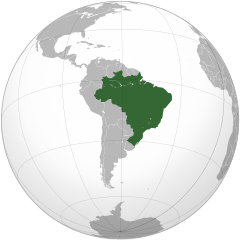
English: Brazil Português: Brasil Русский: Бразилия |
||||
| Fecha | |||||
| Fuente |
Own work using: Aquarius.geomar.de
|
||||
| Outor | Ssolbergj | ||||
| Other versions | Derivative works of this file: LocationBrazil (orthographic).svg | ||||
| SVG genesis |

Mapas na Projeção Cartográfiaca. Mapas en Proyección cartográfica. Orthographic projection maps.
.svg)
.svg)
.svg)
.svg)
.svg)
.svg)
.svg)
.svg)
.svg)
.svg)
.svg)
.svg)
.svg)
.svg)
.svg)
.svg)
.svg)
.svg)
.svg)
.svg)
.svg)
.svg)
.svg)
.svg)
.svg)
.svg)
.svg)
.svg)
.svg)
.svg)
.svg)
.svg)
.svg)
.svg)
.svg)
.svg)
.svg)
.svg)
.svg)
.svg)
.svg)
.svg)
.svg)
.svg)
.svg)
.svg)
.svg)
.svg)
.svg)
.svg)
.svg)
.svg)
.svg)
.svg)
.svg)
.svg)
.svg)
.svg)
.svg)
.svg)
.svg)
.svg)
.svg)
.svg)
.svg)
.svg)
.svg)
.svg)
.svg)
.svg)
.svg)
.svg)
.svg)
.svg)

.svg)

.svg)

.svg)
.svg)
.svg)
.svg)
.svg)
.svg)
.svg)


.svg)
.svg)
.svg)
.svg)
.svg)
.svg)
.svg)

.svg)
.svg)
.svg)
.svg)
.svg)
.svg)
.svg)
.svg)
.svg)

.svg)
.svg)
.svg)
.svg)
.svg)
.svg)
.svg)
_without_national_boundaries.svg)
.svg)
.svg)
.svg)
.svg)
.svg)
.svg)

.svg)
.svg)
.png)
.svg)
.svg)
.svg)
.svg)

.svg)
.svg)
.svg)
.svg)
.svg)
.svg)
.svg)
.svg)
.svg)
.svg)
.svg)

.svg)
.svg)
.svg)
.svg)
.svg)
.svg)
.svg)
.svg)
.svg)

.svg)
.svg)

.svg)
.svg)
.svg)
.svg)
.svg)
.svg)
.svg)
.svg)
.svg)
.svg)
.svg)
.svg)
.svg)
.svg)
.svg)
.svg)
.svg)
.svg)
.svg)
.svg)
.svg)
.svg)
.svg)
.svg)
.svg)
.svg)
.svg)
_-_Crimea_disputed.svg)
.svg)
.svg)
.svg)
.svg)
.svg)
.svg)
.svg)
.svg)
.svg)
.svg)
.svg)
_political.svg)
.svg)
.svg)
.svg)
.svg)
_-_Crimea_disputed_-_no_borders.svg)
.svg)
.svg)
.svg)
.svg)
.svg)
.svg)
.svg)
.svg)
.svg)
.svg)
.svg)

.svg)
.svg)
.svg)

.png)
.svg)
.svg)
.svg)
.svg)
.svg)
.svg)
.svg)
.svg)
.svg)
.svg)
.svg)
.svg)
.svg)
.svg)
.svg)
.svg)
.svg)
.svg)
.svg)
.svg)
.svg)
.svg)
.svg)
.svg)
.svg)
.svg)
.svg)
.svg)
.svg)
.svg)
.svg)
.svg)
.svg)
.svg)
.png)
.svg)
.svg)
.svg)
_(orthographic_projection).png)
.svg)
.svg)
| Orthographic projections maps created by Ssolbergj |
|---|
| Orthographic projections maps created by Ssolbergj: |
.svg)
Lisensia
I, the copyright holder of this work, hereby publish it under the following license:
This file is licensed under the Creative Commons Attribution 3.0 Unported license.
- Bo ta liber:
- pa kompartí – pa kopia, distribuí i transmití e obra
- pa rekombiná – pa adaptá e obra
- Di akuerdo ku e próksimo kondishonnan:
- atribushon – Bo mester duna krédito na e outor, duna un lenk na e lisensia, i indiká si a hasi kambio. Bo por hasi esei na kualke manera rasonabel, perono na manera ku por sugerí ku esun ku ta otorgá e lisensia ta respaldá abo òf bo uzo.
Historia di fail
Klek riba un fecha/ora pa mira e fail, manera e tabata na e momentu ei.
| Fecha/Ora | Miniatura | Dimenshonnan | Usuario | Komentario | |
|---|---|---|---|---|---|
| aktual | 21:59, 30 mart 2021 | | 541 × 541 (88 KB) | Politicsfan4 | Reverted to version as of 20:42, 12 September 2012 (UTC) |
| 14:49, 25 òktober 2020 |  | 550 × 550 (253 KB) | Sette-quattro | more detailed polygons | |
| 20:42, 12 sèptèmber 2012 |  | 541 × 541 (88 KB) | Palosirkka | Scrubbed with http://codedread.com/scour/ | |
| 10:30, 3 novèmber 2008 |  | 541 × 541 (319 KB) | Ssolbergj | Why the new colours? Can you please upload it as a new file? | |
| 05:06, 3 novèmber 2008 |  | 541 × 541 (320 KB) | Huhsunqu | {{Information |Description= |Source= |Date= |Author= |Permission= |other_versions= }} | |
| 00:20, 3 novèmber 2008 |  | 541 × 541 (319 KB) | Ssolbergj | {{Information |Description={{en|1=Brazil}} |Source=Own work, {{Inkscape}}<br />[http://www.aquarius.geomar.de/omc/make_map.html Aquarius.geomar.de]<br />{{GFDL-GMT}} |Author=Ssolbergj |Date=3 November 2008 |Permission= |other_versions={ |
Uso di fail
E próksimo page uses ta uza e fail akí:
Uso global di fail
E próksimo otro wikinan ta usa e fail akí
- Uso na ady.wikipedia.org
- Uso na af.wikipedia.org
- Uso na ami.wikipedia.org
- Uso na ang.wikipedia.org
- Uso na arc.wikipedia.org
- Uso na ar.wikipedia.org
- العلاقات البرازيلية العراقية
- النظام العسكري البرازيلي
- معاملة المثليين في البرازيل
- زواج المثليين في البرازيل
- تبني المثليين للأطفال في البرازيل
- معاملة المثليين في ألاغواس
- قالب:المثلية في البرازيل
- معاملة المثليين في سيارا
- معاملة المثليين في باهيا
- معاملة المثليين في ماتو غروسو دو سول
- معاملة المثليين في سيرغيبي
- معاملة المثليين في المقاطعة الفدرالية البرازيلية
- معاملة المثليين في بارا
- معاملة المثليين في بارانا
- معاملة المثليين في بياوي
- معاملة المثليين في ريو غراندي دو سول
- معاملة المثليين في ريو دي جانيرو (ولاية)
- معاملة المثليين في ساو باولو (ولاية)
- معاملة المثليين في روندونيا
- معاملة المثليين في إسبيريتو سانتو
- أي دي آي 4277 و أي دي بي أف 132
- أر سي أل 12876 و أم أس 32077
- سياسة هجرة المثليين في البرازيل
- حقوق المتحولين جنسيا في البرازيل
- الوضع القانوني للمثلية الجنسية في البرازيل
- السن القانونية للنشاط الجنسي في البرازيل
- سياحة المثليين في البرازيل
- تاريخ المثليين في البرازيل
- كرنفال فلوريانوبوليس للمثليين
- الجنة أند الجحيم
- فخر ساو باولو
- المجلس الوطني لمكافحة التمييز
- المؤسسة البرازيلية للمثليين، والمثليات، مزدوجي التوجه الجنسي، ترافستي، المتحولين جنسيا، وثنائيي الجنس
- مجموعة المثليين في باهيا
- شاطئ مولي
- شاطئ بورتو دا بارا
- شارع فري كانيكا
- شارع فارمي دي أمويدو
- التركيبة السكانية للمثليين في البرازيل
- قوانين مكافحة التمييز في البرازيل
- إيبانيما
- الجمهورية البرازيلية الأولى
- الجمهورية البرازيلية الرابعة
- Uso na avk.wikipedia.org
- Uso na awa.wikipedia.org
Mira mas uzo global di e fail akí.
.svg)
.svg)